Why the station, Landsat, GPS, GOES and Webb fly where they do
Height sets a satellite’s speed; tilt and shape set what it sees. Five neighborhoods, from the station about 400 km up to Webb 1.5 million km away, and the work each one makes possible.
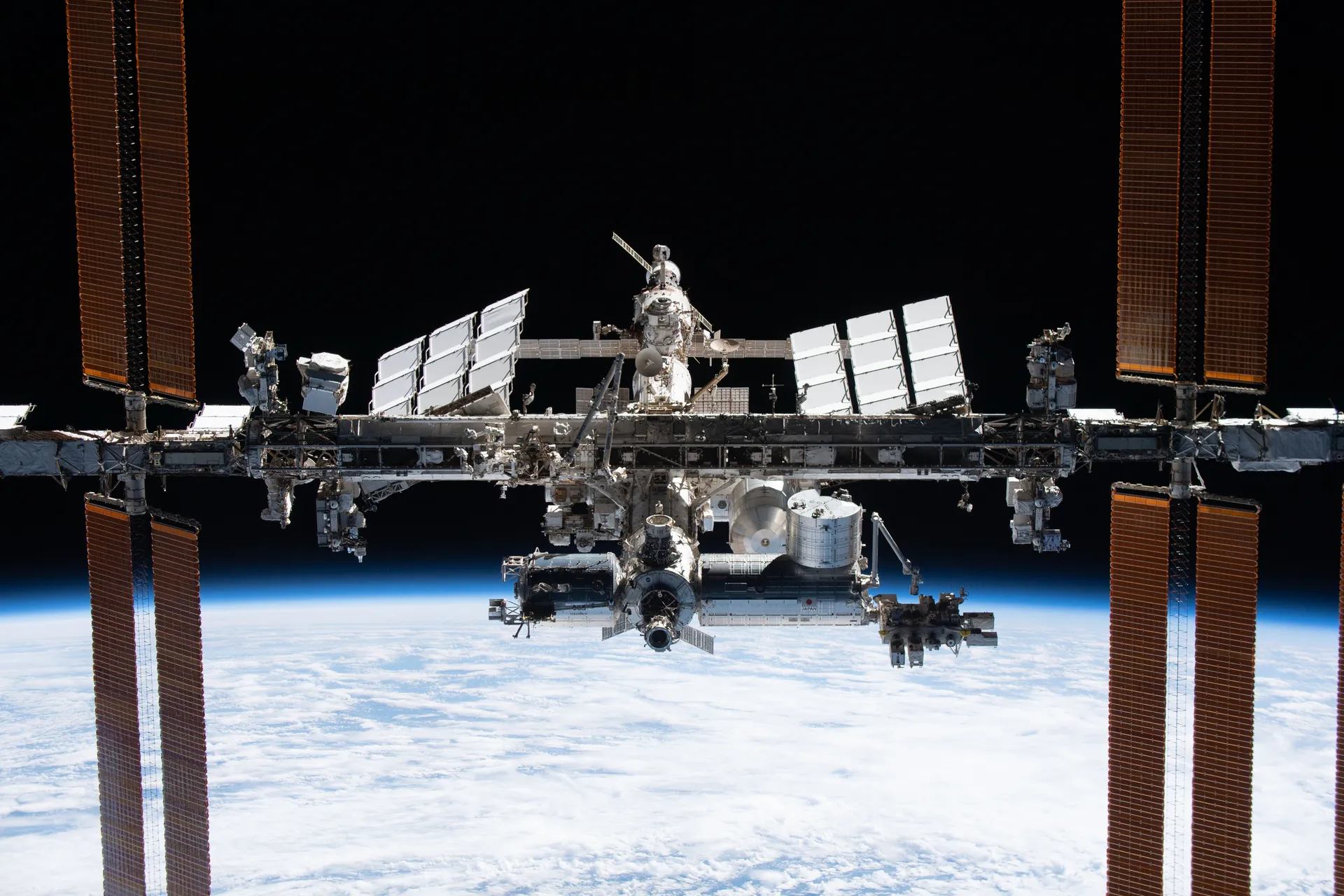
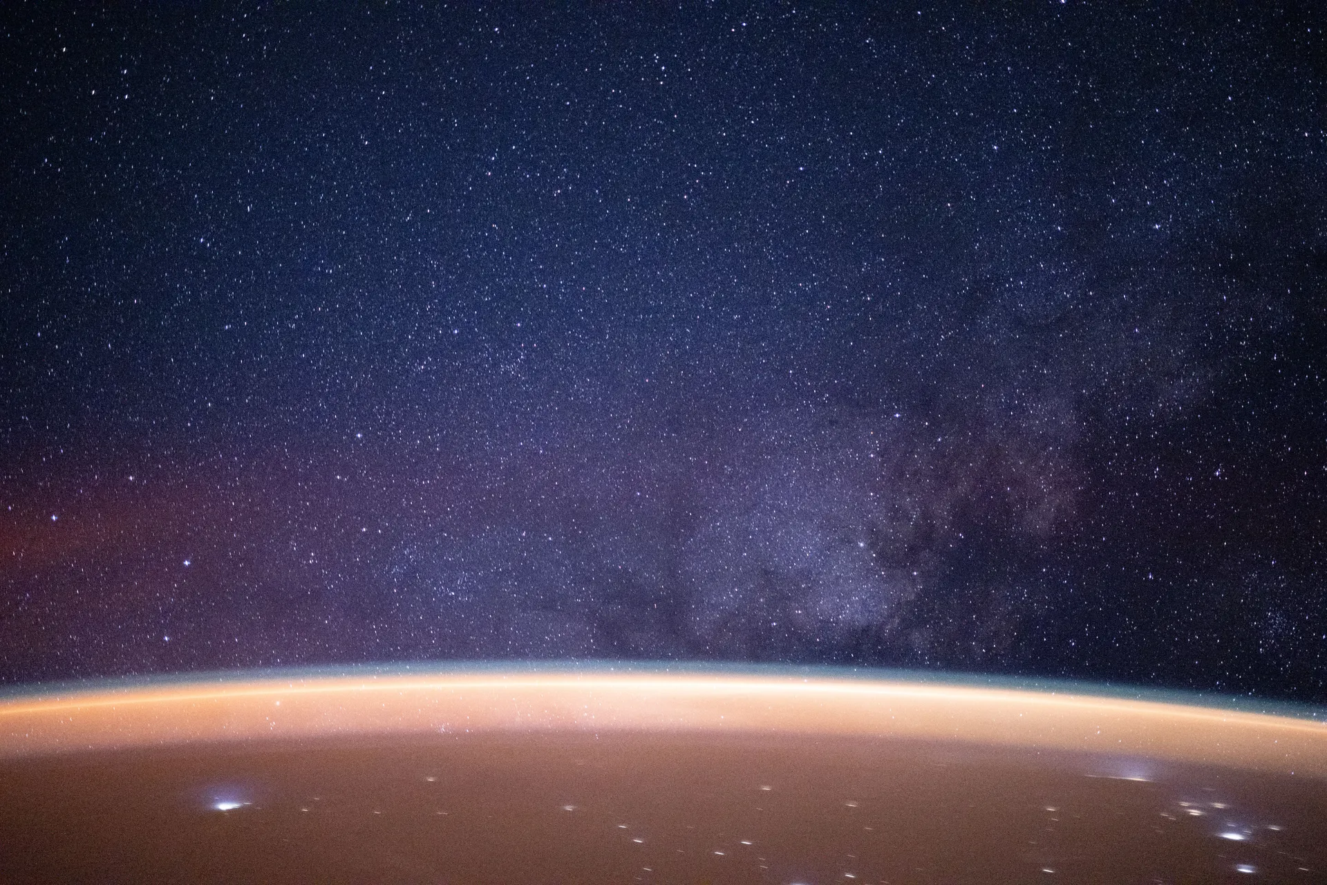
NASA · Expedition 73, October 25, 2025
Drawn from 18 sources: NASA (6), NASA Goddard Scientific Visualization Studio (3), NOAA NESDIS (3), NASA Earth Observatory and 5 others. About 11 minutes. Checked October 1, 2026.
Just as different seats in a theater provide different perspectives on a performance, different Earth orbits give satellites varying perspectives, each valuable for different reasons. Some seem to hover over a single spot, providing a constant view of one face of the Earth, while others circle the planet, zipping over many different places in a day.1
There are essentially three types of Earth orbit: high, medium and low. Many weather and some communications satellites have a high Earth orbit, farthest from the surface. Satellites in medium Earth orbit include navigation satellites. Most scientific satellites, including NASA’s Earth Observing System fleet, have a low Earth orbit.1 Farther out still, about 1.5 million kilometers from Earth, are balance points where a spacecraft can keep pace with our planet as it circles the Sun.15
Height sets the speed
The height of the orbit, or distance between the satellite and Earth’s surface, determines how quickly the satellite moves around the Earth. An Earth-orbiting satellite’s motion is mostly controlled by Earth’s gravity. As satellites get closer to Earth, the pull of gravity gets stronger, and the satellite moves more quickly. NASA’s Aqua satellite, for example, requires about 99 minutes to orbit the Earth at about 705 kilometers up, while a weather satellite about 36,000 kilometers from Earth’s surface takes 23 hours, 56 minutes and 4 seconds to complete an orbit. At 384,403 kilometers from the center of the Earth, the Moon completes a single orbit in 28 days.1
Changing a satellite’s height will also change its orbital speed, and this introduces a strange paradox. An operator who wants to increase a satellite’s orbital speed can’t simply fire the thrusters to accelerate it: doing so would boost the orbit, which would slow the orbital speed. Instead, the thrusters must fire in a direction opposite to the satellite’s forward motion, an action that on the ground would slow a moving vehicle. This change pushes the satellite into a lower orbit, which increases its forward velocity.1
In addition to height, eccentricity and inclination also shape a satellite’s orbit. Eccentricity refers to the shape of the orbit: a satellite with a low-eccentricity orbit moves in a near circle, while an eccentric orbit is elliptical, with the satellite’s distance from Earth changing depending on where it is in its orbit. Inclination is the angle of the orbit in relation to Earth’s equator. A satellite that orbits directly above the equator has zero inclination; one that travels from the North Pole to the South Pole has an inclination of 90 degrees. Together, height, eccentricity and inclination determine the satellite’s path and what view it will have of Earth.1
- 99min
- One orbit of a polar Earth-observing satellite at 705 km1
- 12h
- One orbit of a GPS satellite at 20,200 km1
- 23 h 56min
- One orbit at geostationary height, matching one turn of the Earth1
- 28days
- One orbit of the Moon, 384,403 km from Earth’s center1
160 to 2,000 km up
Low Earth orbit
The Space Station circles at about 420 km, once every 92 minutes. Crew capsules, cargo ships and most Earth-observing satellites work here.
about 705 km, over the poles
Sun-synchronous orbit
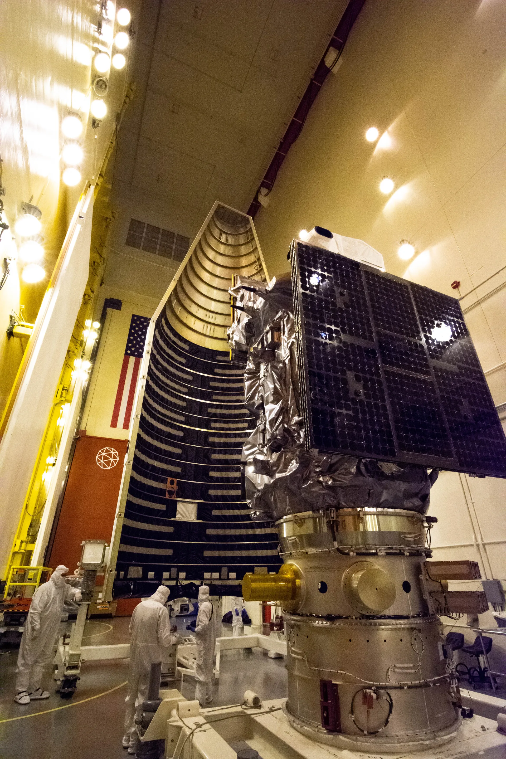
Landsat passes almost over the poles and crosses the equator at the same local time each day, so every picture of a place is lit the same way.
20,200 km up
Medium Earth orbit
GPS satellites fly in six orbital planes and circle twice a day. At least four are above the horizon anywhere on Earth at any moment.
35,786 km up, over the equator
Geostationary orbit
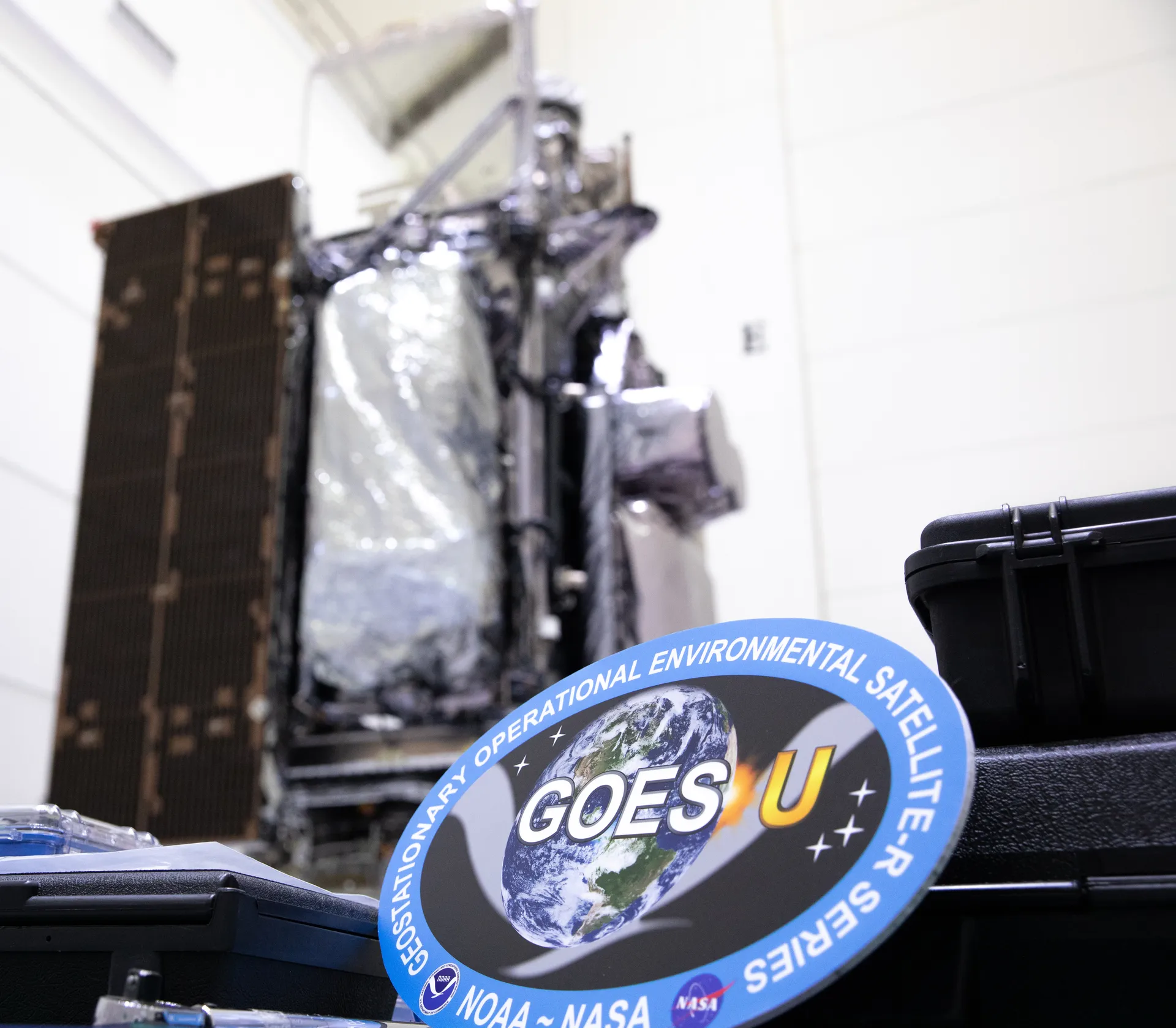
Here a satellite circles once a day and seems to hang over one place. NOAA’s GOES satellites watch the Americas from two such points.
1.5 million km away
Sun–Earth L2
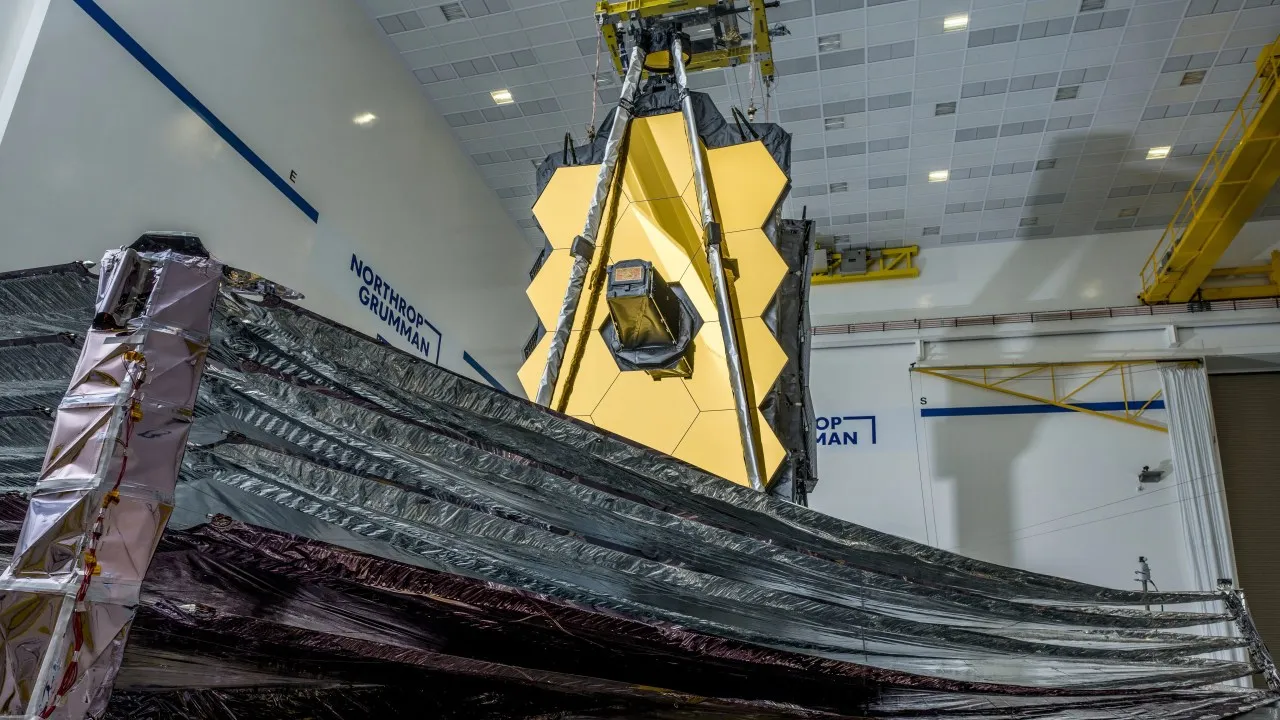
Webb orbits a balance point on the far side of Earth from the Sun, where Sun, Earth and Moon all stay behind its sunshield.
Drag to turn. Distances and sizes are to scale.
Low Earth orbit: close enough to reach in hours
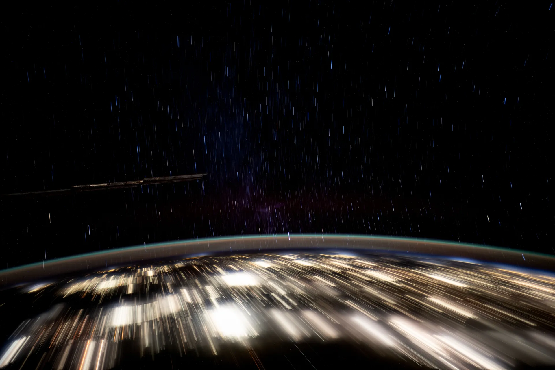
A long exposure from the station turns the lights of Mexico’s Yucatán peninsula into streaks, January 23, 2025.
Low Earth orbit starts just above the top of the atmosphere. Most scientific satellites and many weather satellites are in a nearly circular low Earth orbit, and a satellite’s inclination depends on what it was launched to monitor: a mission to measure tropical rainfall flew at 35 degrees and stayed near the equator.1
The International Space Station is the best-known resident. Its crew travels at five miles per second, orbiting Earth about every 90 minutes; in 24 hours the station makes 16 orbits and passes through 16 sunrises and sunsets, and its path takes it over 90 percent of the Earth’s population.2 On the night of October 25, 2025, when the photograph at the top of this page was taken, it was 258 miles up.18 The station orbits at an inclination of 51.6 degrees, chosen so that both American and Russian rockets can reach it. A low inclination lets a launch borrow speed from Earth’s rotation; a polar-orbiting satellite gets no help from Earth’s momentum and needs more energy to reach the same altitude.1
Closeness is what makes the station a place where people work. A spacecraft can arrive as soon as four hours after launching from Earth.2 Crew-13, launched from Cape Canaveral on the morning of October 1, 2026, was planned to dock to the Harmony module that evening, about 7 hours and 50 minutes after liftoff.3 The same closeness has a cost: even the thinnest top layers of the atmosphere tug on everything in low orbit.1
Sun-synchronous orbit: the same light on every pass
Many of the satellites in NASA’s Earth Observing System have a nearly polar orbit. In this highly inclined orbit, the satellite moves around the Earth from pole to pole, taking about 99 minutes to complete an orbit. During one half of the orbit, the satellite views the daytime side of the Earth; at the pole, it crosses over to the nighttime side. As the satellites orbit, the Earth turns underneath. By the time a satellite crosses back into daylight, it is over the region next to the area seen in its last orbit. In a 24-hour period, polar-orbiting satellites view most of the Earth twice: once in daylight and once in darkness.1
Just as geosynchronous satellites have a sweet spot over the equator that lets them stay over one spot on Earth, polar-orbiting satellites have a sweet spot that allows them to stay in one time. This is a sun-synchronous orbit: whenever and wherever the satellite crosses the equator, the local solar time on the ground is always the same.1 Aqua always crosses the equator from south to north at about 1:30 p.m. local time.5
The sun-synchronous orbit is necessary for science because it keeps the angle of sunlight on the surface of the Earth as consistent as possible, though the angle changes from season to season. This consistency means that scientists can compare images from the same season over several years without worrying too much about extreme changes in shadows and lighting, which can create illusions of change.1
Landsat works the same way. Landsat 9 flies a sun-synchronous, near-polar orbit 705 kilometers up, inclined 98.2 degrees. It repeats its ground track every 16 days, crosses the equator at 10:12 a.m., give or take five minutes, and flies eight days apart from Landsat 8, so that together they cover the planet’s land every eight days.4 The path a satellite has to travel to stay sun-synchronous is very narrow. Any deviation in height or inclination will take it out of the orbit, and since atmospheric drag and the tug of the Sun and Moon alter a satellite’s orbit, it takes regular adjustments to stay there.1
Medium Earth orbit: twelve hours and a predictable sky
Satellites in medium Earth orbit move more quickly than those far above them. The semi-synchronous orbit is a near-circular orbit 26,560 kilometers from the center of the Earth, about 20,200 kilometers above the surface. A satellite at this height takes 12 hours to complete an orbit. As the satellite moves, the Earth rotates underneath it, and in 24 hours the satellite crosses over the same two spots on the equator. This orbit is consistent and highly predictable. It is the orbit used by the Global Positioning System.1
The GPS satellites are arranged in six equally spaced orbital planes surrounding the Earth. Each plane contains four slots occupied by baseline satellites, and this 24-slot arrangement ensures that users can see at least four satellites from virtually any point on the planet. The Space Force normally flies more than 24, to keep coverage whenever baseline satellites are serviced or retired; it has flown 31 operational satellites for well over a decade.6
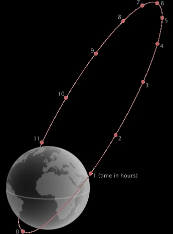
The second common medium Earth orbit is the Molniya orbit, invented in the Soviet Union for high latitudes. A geostationary satellite is parked over the equator, so far northern and southern places are always at the edge of its view. The Molniya orbit combines a high inclination, 63.4 degrees, with a high eccentricity, 0.722, to maximize viewing time over high latitudes.1
The satellite moves in an extreme ellipse with the Earth close to one edge. Accelerated by Earth’s gravity, it moves very quickly when it is close to the planet; as it moves away it slows, so it spends more time at the top of its orbit, farthest from the Earth. A Molniya orbit takes 12 hours, but the satellite spends about two-thirds of that time over one hemisphere, and like a semi-synchronous satellite it passes over the same path every 24 hours. That makes the orbit useful for communications in the far north or south.1
Geostationary orbit: a view that never leaves
When a satellite reaches exactly 42,164 kilometers from the center of the Earth (about 36,000 kilometers from the surface), it enters a sort of sweet spot in which its orbit matches Earth’s rotation. Because the satellite orbits at the same speed that the Earth turns, it seems to stay in place over a single longitude. A satellite in a circular geosynchronous orbit directly over the equator has a geostationary orbit that does not move at all relative to the ground: it is always directly over the same place on the Earth’s surface.1
A geostationary orbit is extremely valuable for weather monitoring because satellites in this orbit provide a constant view of the same surface area. When you look at the satellite view of your hometown on a weather website, the image comes from a satellite in geostationary orbit.1 NOAA’s GOES satellites orbit 22,236 miles above the equator. GOES-19 operates as NOAA’s GOES East satellite and GOES-18 as GOES West; together they watch over more than half the globe, from the west coast of Africa to New Zealand and from near the Arctic Circle to the Antarctic Circle. Their imagers can return pictures of storms as often as every 30 seconds.7
Because geostationary satellites are always over a single location, they are also useful for communication.1 NASA’s own relay network works from there. Its Tracking and Data Relay Satellites, in geosynchronous orbit over the Atlantic, Pacific and Indian Oceans, relay data for more than 25 missions, including the Hubble Space Telescope and the International Space Station, and provide near-constant links between spacecraft below geosynchronous orbit and NASA’s ground stations in White Sands, New Mexico, and Guam.9
The fixed view has limits. A satellite over the equator sees high latitudes only at a grazing angle, which is one reason the polar and Molniya orbits exist.1 NOAA pairs the two kinds of orbit. The GOES satellites keep continual watch on one hemisphere as storms develop, while polar-orbiting satellites let the Earth do the hard work, rotating beneath them so they can see the weather around the whole planet every day.8
Lagrange points: keeping pace with Earth around the Sun
Lagrange points are positions in space where objects sent there tend to stay put. At a Lagrange point, the gravitational pull of two large masses precisely equals the centripetal force required for a small object to move with them, so spacecraft can use these points to reduce the fuel needed to remain in position.10 Of the five Lagrange points in the Sun–Earth system, only L4 and L5 are stable. A satellite at the other three is like a ball balanced at the peak of a steep hill: any slight perturbation will push it out.1 The L1 and L2 points are unstable on a time scale of about 23 days, which requires the satellites orbiting them to make regular course corrections.10
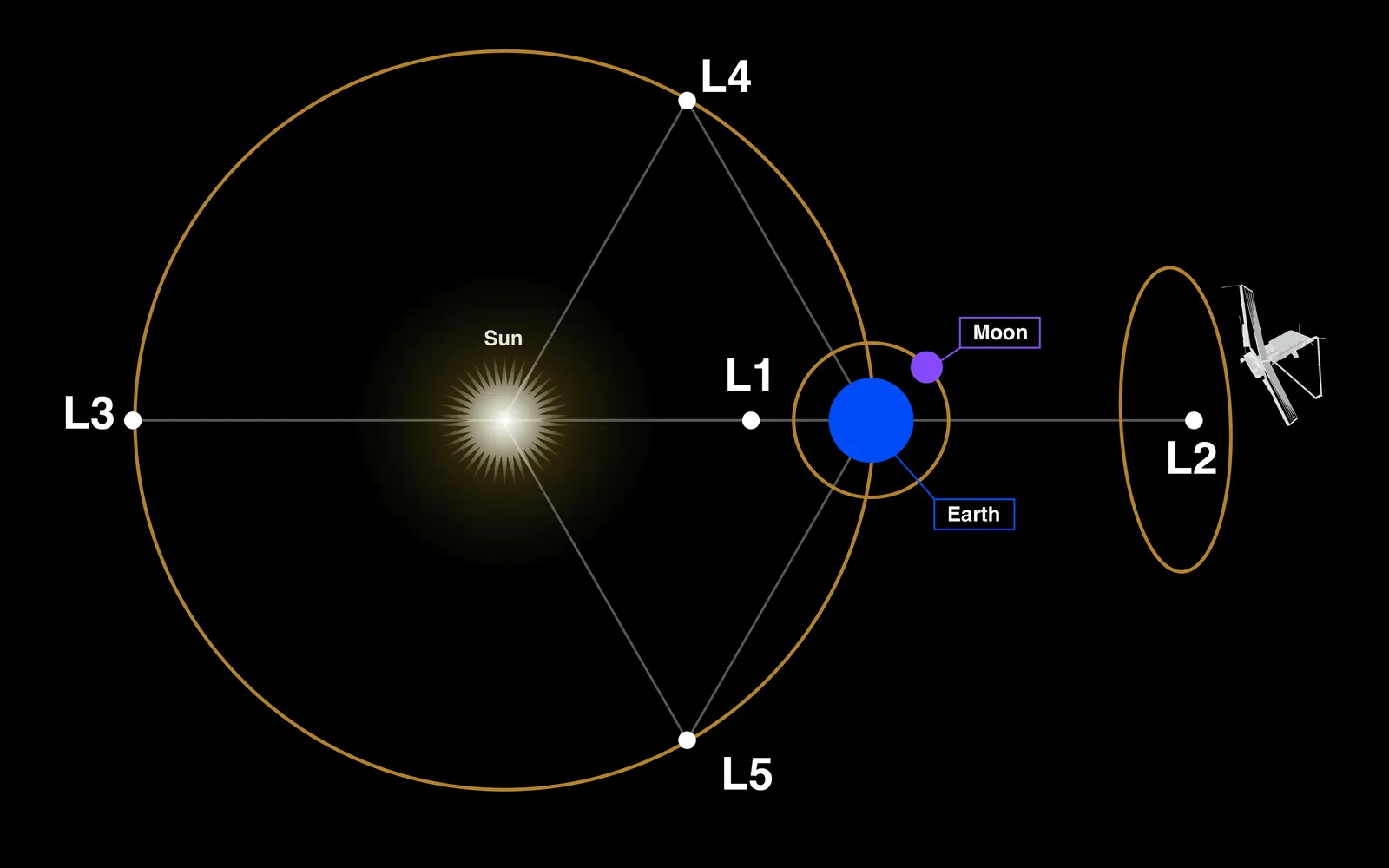
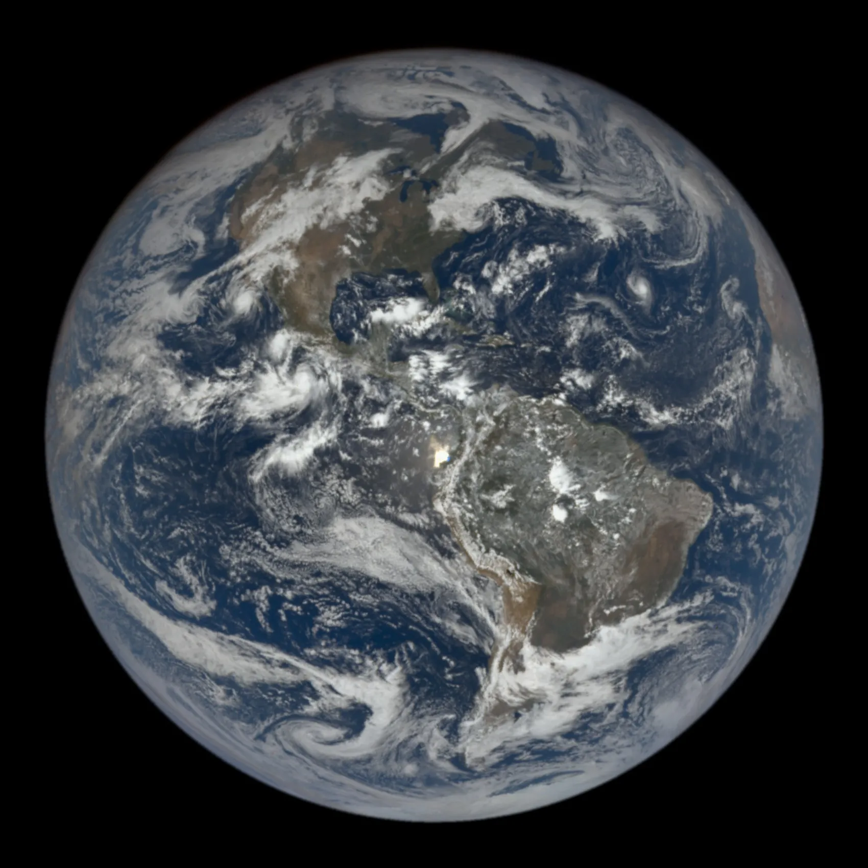
The first Lagrange point lies between the Earth and the Sun, giving satellites there a constant view of the Sun.1 SOHO, the joint ESA–NASA Solar and Heliospheric Observatory, launched in December 1995 and has watched the Sun from L1 ever since, long past the planned end of its mission in 1998.13
L1 is also where space weather warnings begin. The solar wind reaches L1 up to an hour before it reaches Earth, so NOAA’s Deep Space Climate Observatory, launched in February 2015, can typically give 15 to 60 minutes of warning before a coronal mass ejection arrives.11 NOAA’s newest satellite there, SOLAR-1, launched as SWFO-L1 and renamed once it reached its orbit around L1, is the first NOAA satellite designed specifically for continuous, operational space weather observations. Images from its coronagraph reach forecasters within 30 minutes; a research instrument such as SOHO’s coronagraph can take up to eight hours.12 NASA’s IMAP joined them at L1 on January 10, 2026.14
The second Lagrange point is about the same distance from the Earth, but on the far side: Earth is always between L2 and the Sun.1 The James Webb Space Telescope does not orbit the Earth, as the Hubble Space Telescope does. It orbits the Sun, 1.5 million kilometers (1 million miles) from the Earth near L2, and the special thing about that orbit is that it keeps the telescope in line with the Earth as both move around the Sun. That lets the observatory’s large sunshield protect the telescope from the light and heat of the Sun and Earth, and the Moon.15
Webb primarily observes infrared light, which can sometimes be felt as heat, so it must be shielded from any bright, hot source. For the sunshield to protect against the Sun, Earth and Moon, these bodies all have to be in the same direction, which is why the telescope is out at L2. Webb orbits around L2 rather than sitting on it, in a loop about the size of the Moon’s orbit around the Earth that takes about six months and keeps it out of the shadows of both the Earth and the Moon.15 Because L2 always lies in the same direction from Earth, the Deep Space Network’s antennas in Australia, Spain and California can stay in contact as the Earth turns.15 NASA’s Nancy Grace Roman Space Telescope launched for the same destination on August 30, 2026.16
Drag, gravity and debris: why satellites keep maneuvering
Once a satellite is in orbit, it usually takes some work to keep it there. Since Earth isn’t a perfect sphere, its gravity is stronger in some places than others. This unevenness, along with the pull of the Sun, the Moon and Jupiter, changes the inclination of a satellite’s orbit. GOES satellites have to be moved three or four times over their lifetimes to keep them in place, and NASA’s low Earth orbit satellites adjust their inclination every year or two to stay sun-synchronous.1
Satellites in low Earth orbit are also pulled out of their orbits by drag from the atmosphere, and drag is stronger when the Sun is active. Just as the air in a balloon expands when heated, the atmosphere rises and expands when the Sun adds energy to it, so at solar maximum a satellite moves through denser air. When the Sun is quiet, satellites in low Earth orbit have to boost their orbits about four times a year; when solar activity is at its greatest, a satellite may have to be maneuvered every two to three weeks.1
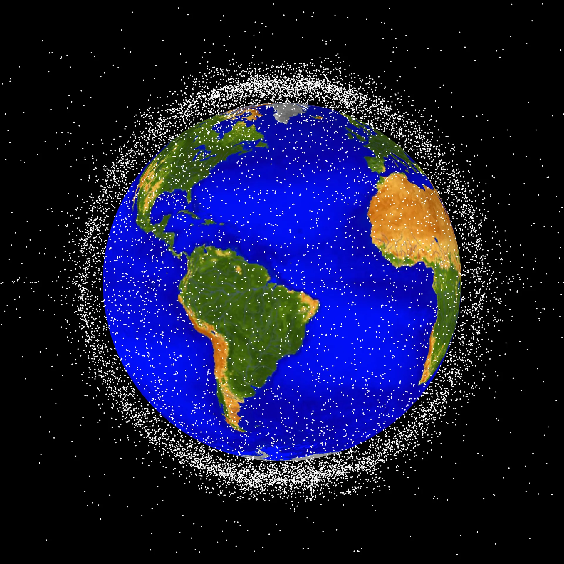
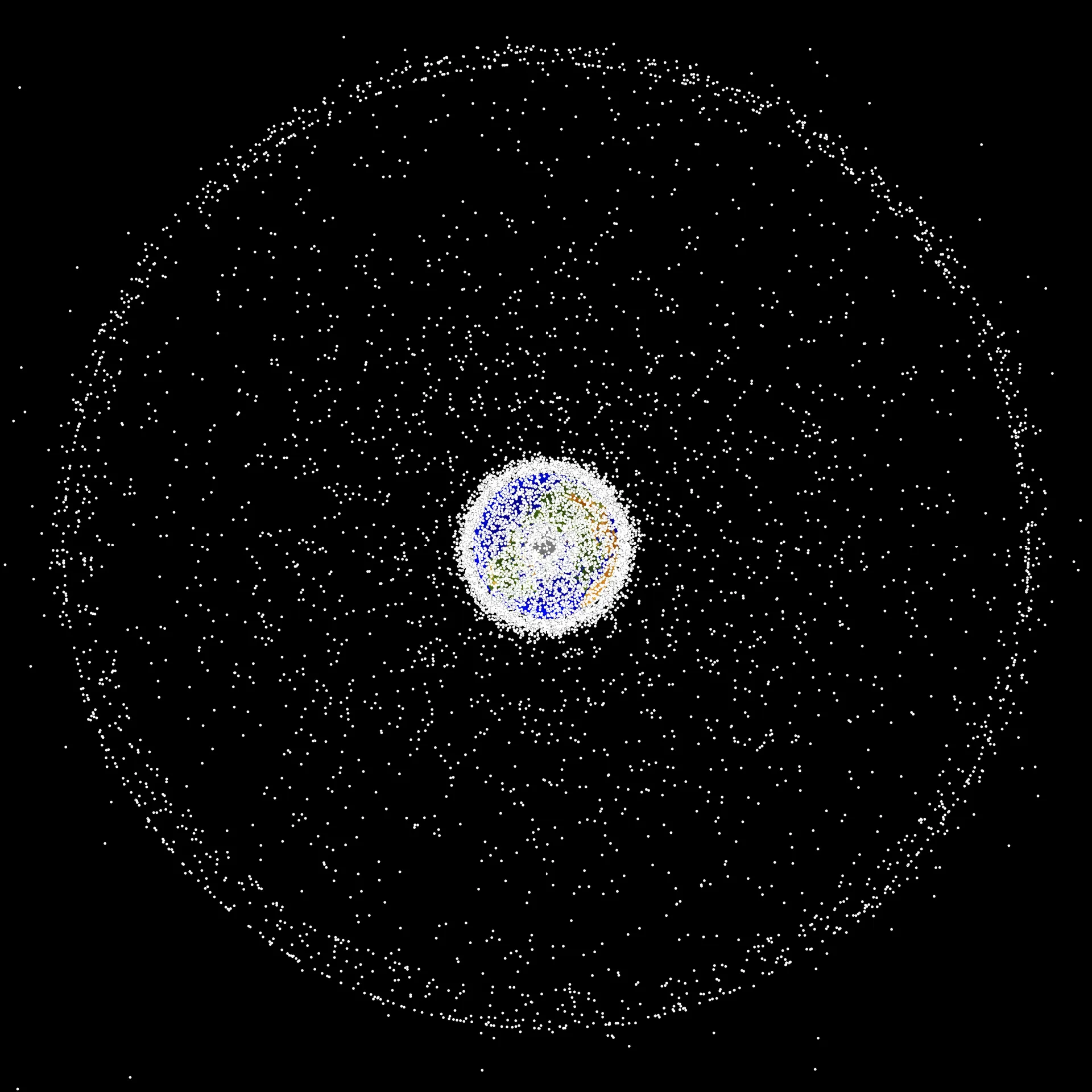
The third reason to move a satellite is to get out of the way of debris. On February 10, 2009, a communications satellite owned by Iridium, a U.S. company, collided with a non-functioning Russian satellite 790 kilometers above the Earth. Both broke apart, creating a field of at least 2,500 pieces.1,17 More than 25,000 objects larger than 10 centimeters are now known, along with an estimated 500,000 particles between 1 and 10 centimeters and more than 100 million larger than a millimeter; the large ones are tracked routinely by the U.S. Space Surveillance Network. Most orbital debris is within 2,000 kilometers of the surface, and the greatest concentration is near 750 to 1,000 kilometers.17 Pieces of the Iridium collision were propelled down to 705 kilometers, the height of NASA’s Earth Observing System satellites, where engineers now plan avoidance maneuvers around them.1
Sources
The text above is drawn from these 18 sources. Government works are adapted closely; company and press material is summarized. Numbers in the text point here. Last checked October 1, 2026.
Show all 18 sourcesShow fewer
- 1Back to the text
- 2Back to the text
- 3Back to the text
- 4Back to the text
- 5Back to the text
- 6Back to the text
- 7Back to the text
- 8Back to the text
- 9Back to the text
- 10Back to the text
- 11Back to the text
- 12Back to the text
- 13Back to the text
- 14Back to the text
- 15Back to the text
- 16Back to the text
- 17Back to the text
- 18Back to the text
Continue
Related stories
- Weather satellitesTwo GOES satellites stare at the Americas from 22,236 miles up while polar orbiters circle the globe. NASA builds them, NOAA flies them, and Congress is deciding how much of the next generation to pay for.
- LandsatSince 1972 Landsat satellites have recorded Earth’s land, and since 2008 anyone can download the record free. NASA builds them and the USGS runs them; the next one has been redesigned, and its budget is in dispute.
- ISSHow five space agencies assembled the largest structure ever flown, what it has cost the United States, why its oldest Russian tunnel leaks, and how NASA plans to bring it down after 2030.