How GPS turns atomic time into position, and who keeps it running
A receiver finds itself by timing signals from four satellites. The Space Force runs the system, finished GPS III in April 2026, and canceled the ground system that was meant to replace the old one.
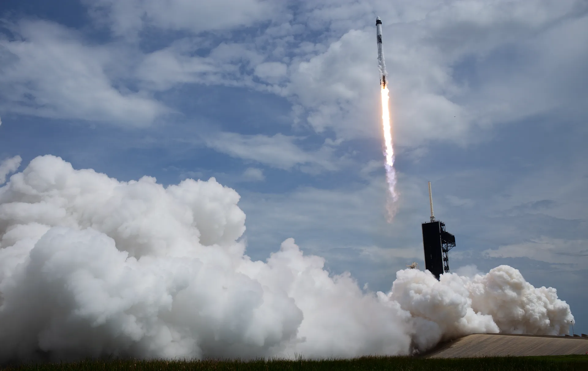
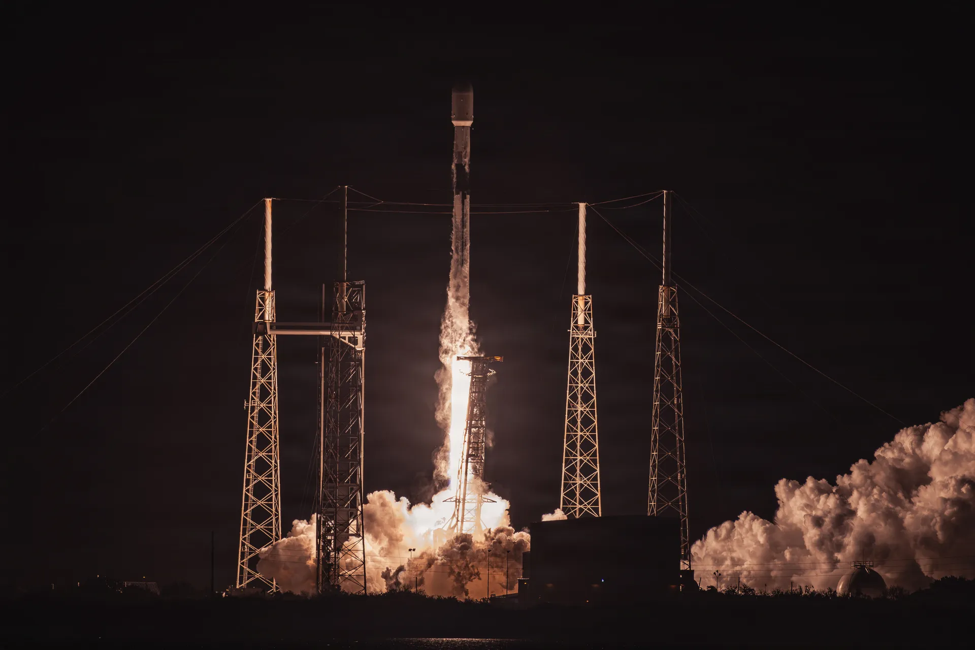
U.S. Space Force/Gwendolyn Kurzen · GPS III SV-10, April 21, 2026
Drawn from 24 sources: GPS.gov (9), U.S. Government Accountability Office (6), GPS.gov (National Coordination Office for Space-Based Positioning, Navigation, and Timing), U.S. Space Force, Space Systems Command and 7 others. About 12 minutes. Checked October 1, 2026.
The Global Positioning System is a U.S.-owned utility that provides users with positioning, navigation and timing. It has three parts: the space segment, the control segment and the user segment. The U.S. Space Force develops, maintains and operates the first two. The space segment is a constellation of satellites that transmit one-way signals giving each satellite’s position and the time; the control segment is a worldwide network of stations that keeps the satellites in their proper orbits and adjusts their clocks; the user segment is the receivers that turn those signals into a three-dimensional position and the time.1
The civilian service is freely available to all users on a continuous, worldwide basis. The military service is available to U.S. and allied armed forces and to approved government agencies.1 Because the satellites only broadcast, the system can serve any number of receivers at once, and a receiver never tells a satellite where it is.1,10
Six orbital planes and at least four satellites in view
GPS satellites fly in medium Earth orbit at an altitude of approximately 20,200 kilometers (12,550 miles), and each circles the Earth twice a day. They are arranged in six equally spaced orbital planes surrounding the Earth. Each plane contains four slots occupied by baseline satellites, and this 24-slot arrangement ensures that users can see at least four satellites from virtually any point on the planet.2
The United States is committed to maintaining at least 24 operational GPS satellites, 95 percent of the time, and the Space Force has flown 31 operational satellites for well over a decade. In June 2011 the Air Force expanded three of the 24 slots and repositioned six satellites, so that GPS now effectively operates as a 27-slot constellation with better coverage in most parts of the world. The extra satellites improve performance but are not counted as part of the core constellation.2 After the last GPS III satellite reached orbit in April 2026, the Space Force counted 32 satellites in the active constellation.3
20,200 km up
Medium Earth orbit
GPS satellites fly in six orbital planes and circle twice a day. At least four are above the horizon anywhere on Earth at any moment.
Drag to turn. Distances and sizes are to scale.
The system is older than most of the people who use it. The first GPS satellite launched in 1978, and the constellation reached full operational capability in April 1995.10 Through the 1990s the civil signal was deliberately degraded by a feature called Selective Availability, which could make a civilian reading wrong by as much as a football field. In May 2000, President Bill Clinton directed the Department of Defense to turn it off. On the day it was switched off, civil GPS accuracy improved tenfold, and in 2007 the government announced that GPS III satellites would be built without the feature.13
Every position is a timing measurement
GPS satellites carry atomic clocks that provide extremely accurate time. The time is written into the codes each satellite broadcasts, so that a receiver can always tell when a signal was sent, and the signal also carries the data a receiver needs to compute where the satellite was. The receiver uses the difference between the time it receives the signal and the time it was sent to compute the distance, or range, to the satellite. It must also account for the signal slowing down as it passes through the ionosphere and the troposphere.4
NOAA Ocean Service
NOAA Ocean Service
NOAA Ocean Service
NOAA Ocean Service
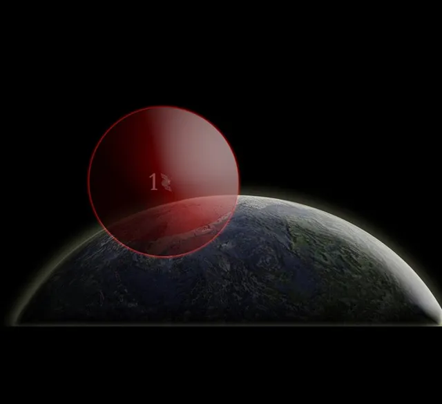
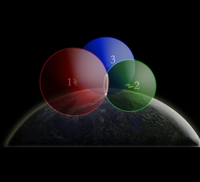
One satellite: a sphere
Radio signals travel at 186,000 miles per second, so the signal’s travel time multiplied by that speed gives the distance to the satellite. If you were 15,000 miles from a single satellite, you could be anywhere on an imaginary sphere around it with a radius of 15,000 miles.5
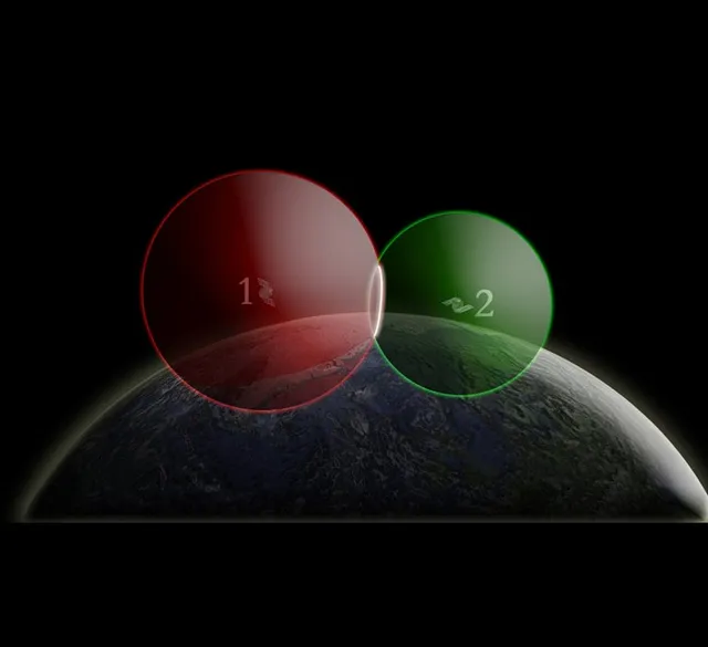
Two satellites: a circle
Add a second satellite, about 12,000 miles away, and you can only be where the two imaginary spheres intersect: the white circle.5
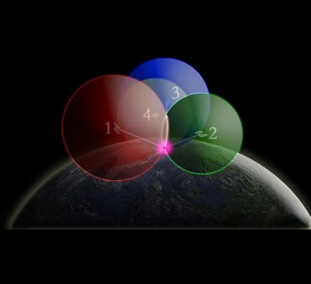
Four satellites: the receiver’s own clock
A receiver’s clock is not an atomic clock, and every timing error becomes a distance error. A measurement from a fourth satellite lets the receiver solve for its own clock error instead. With four satellites, it computes latitude, longitude, altitude and time.4,5
Time to 100 billionths of a second, position to a few meters
In addition to longitude, latitude and altitude, GPS provides a critical fourth dimension: time. Each GPS satellite contains multiple atomic clocks that contribute very precise time data to the GPS signals. Receivers decode these signals, effectively synchronizing themselves to the atomic clocks. This lets users determine the time to within 100 billionths of a second, without the cost of owning and operating atomic clocks.6
That shared clock holds together systems that never show a map. Power companies have fundamental requirements for time and frequency to transmit and distribute power efficiently. Repeated blackouts led many to place GPS-based time synchronization devices in power plants and substations, and by analyzing the precise timing of an electrical anomaly as it propagates through a grid, engineers can trace back the exact location of a power line break. Seismic networks use GPS time to locate the epicenters of earthquakes quickly, and national laboratories compare their atomic clocks through GPS to establish Coordinated Universal Time.7
How accurate a position is depends on more than the satellites. The government commits to broadcasting the GPS signal in space with a daily global average user range error of no more than 2.0 meters, 95 percent of the time; on April 20, 2021, the measured figure was 0.643 meters. What a user gets also depends on satellite geometry, signal blockage, atmospheric conditions and the design of the receiver. GPS-enabled smartphones are typically accurate to within a 4.9-meter (16-foot) radius under open sky, and worse near buildings, bridges and trees. High-end users with dual-frequency receivers and augmentation systems can fix their position within a few centimeters in real time.8
- 4.9m
- Typical smartphone accuracy under open sky8
- 0.643m
- Global average signal-in-space error, April 20, 2021 (the commitment is 2.0 m)8
- 30ns
- Committed accuracy of GPS time against UTC (USNO), 95 percent of the time8
GPS III: ten satellites, launched from 2018 to 2026
The GPS constellation is a mix of old and new satellites. GPS III, the newest generation, carries all the signals of the Block IIF satellites before it and adds a fourth civil signal, L1C, along with enhanced reliability, accuracy and integrity; it has no Selective Availability, and each satellite is designed to last 15 years.2 The first GPS III satellite was originally expected to be available for launch in April 2014. Development problems, mainly with its navigation payload, pushed that back by years,14 and the first one launched in 2018.2
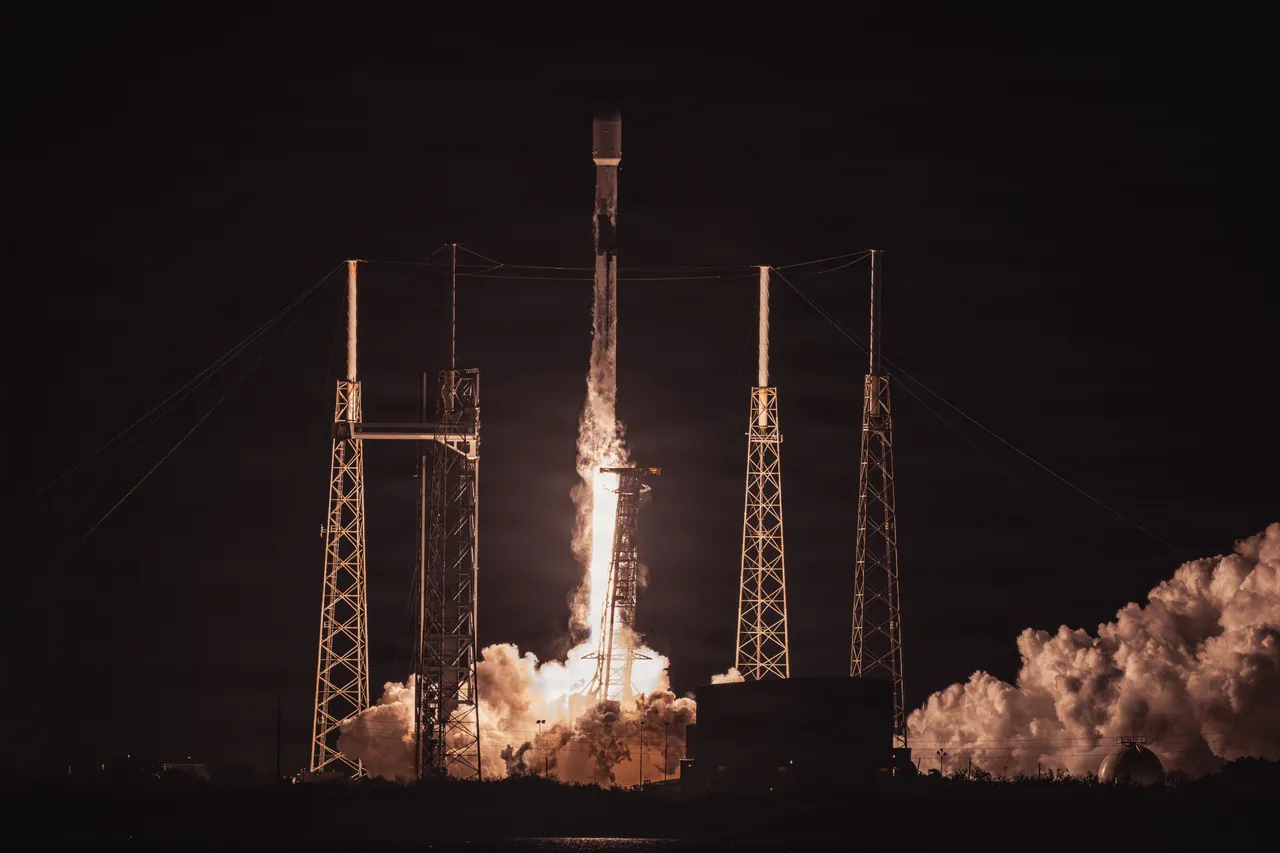
The tenth and last, Space Vehicle 10, launched on a SpaceX Falcon 9 from Space Launch Complex 40 at Cape Canaveral Space Force Station at 2:53 a.m. EDT on April 21, 2026. The Space Force had switched the mission to a different launch provider less than seven weeks earlier, the latest of several accelerated GPS III launches after SV-07 in December 2024, SV-08 in May 2025 and SV-09 in January 2026. A common integration standard, Lockheed Martin’s modular interface design for GPS III, let the satellites fly on rockets from more than one company.3
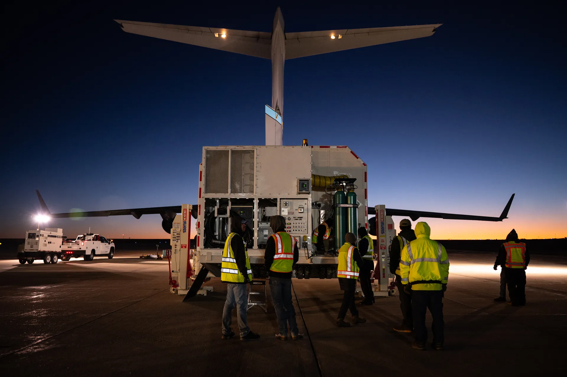
SV-10 added another satellite broadcasting M-code, the military signal that the Space Force says is three times more accurate and eight times more resistant to jamming than the signals of the previous constellation.3
It also carried four demonstrations. An optical crosslink payload tests laser links between satellites, which could make the ground segment more resilient and let operators task satellites faster. A new space-qualified atomic clock, the Digital Rubidium Atomic Frequency Standard, widens the sources of clocks for later satellites. A laser retroreflector array lets NASA make precise range measurements and improve the long-term determination of Earth’s center. And a 3D-printed omni antenna for telemetry, tracking and command cut production time and cost by nearly 60 percent.3
NASA led an interagency team to put laser retroreflectors on GPS III so that ground stations can range to the satellites with lasers, find systematic errors in the radio measurements, and improve the Earth-centered reference frame on which GPS positions rest.11
Four civil signals, phased in one satellite at a time
A major focus of GPS modernization is the addition of new navigation signals. The legacy civil signal, L1 C/A, continues to broadcast, and three newer civil signals—L2C, L5 and L1C—are being fielded as new satellites replace old ones. Most of the new signals will be of limited use until they are broadcast from 18 to 24 satellites, and users must upgrade their equipment to benefit from them.12
L2C, the second civil signal, was designed for commercial needs. Combined with L1 C/A in a dual-frequency receiver, it allows ionospheric correction, a technique that boosts accuracy. The first satellite carrying it launched in 2005, and the Commerce Department estimates that L2C could generate $5.8 billion in economic productivity benefits through 2030. L5, the third, broadcasts in a radio band reserved exclusively for aviation safety services, with higher power and greater bandwidth; the first satellite with a full L5 transmitter launched in May 2010. L1C, the fourth, was developed by the United States and Europe as a common civil signal for GPS and Europe’s Galileo, and the first GPS satellite carrying it launched in December 2018.12 Every GPS III satellite broadcasts it.2 When GPS.gov last updated the signals’ status, in July 2023, L2C and L5 were still pre-operational, to be used at the user’s own risk.12
A squadron at Schriever and stations around the world
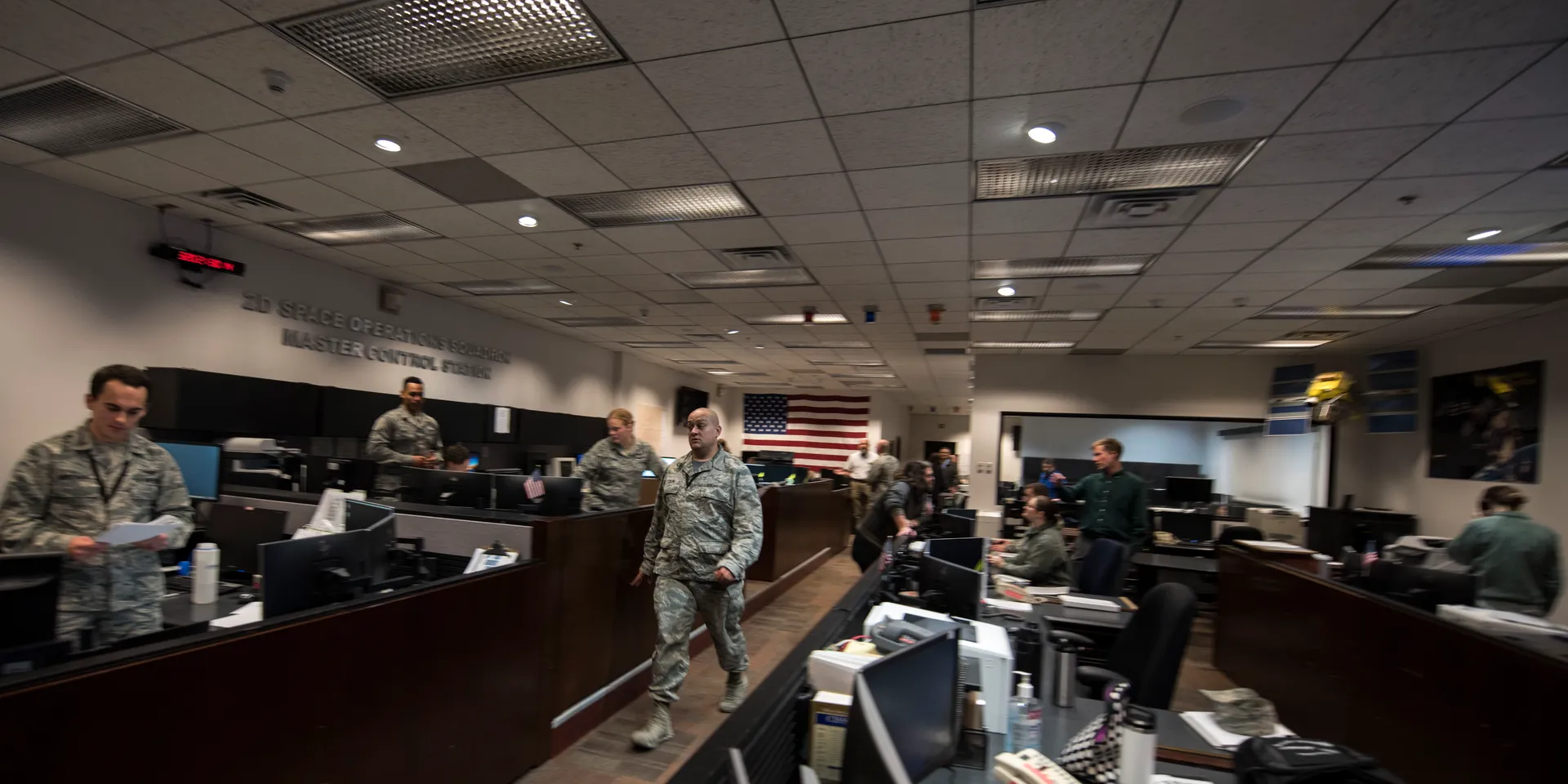
The people who fly GPS are the U.S. Space Force’s 2nd Navigation Warfare Squadron, formerly the 2nd Space Operations Squadron, and the Air Force Reserve’s 19th Space Operations Squadron. Together, nicknamed Team Blackjack, they keep the satellites flying around the clock from Schriever Space Force Base, Colorado.9 The squadron belongs to Mission Delta 31, which provides, operates and sustains satellite control and navigation warfare under the Space Force’s Combat Forces Command. Buying and launching the satellites is a separate job: Space Systems Command, in El Segundo, California, acquires them and gets them to orbit through its National Security Space Launch program.3
Their tools are the control segment, a global network of ground facilities that track the GPS satellites, monitor their transmissions, perform analyses, and send commands and data to the constellation. The current Operational Control Segment includes a master control station, an alternate master control station, 11 command and control antennas and 16 monitoring sites.9
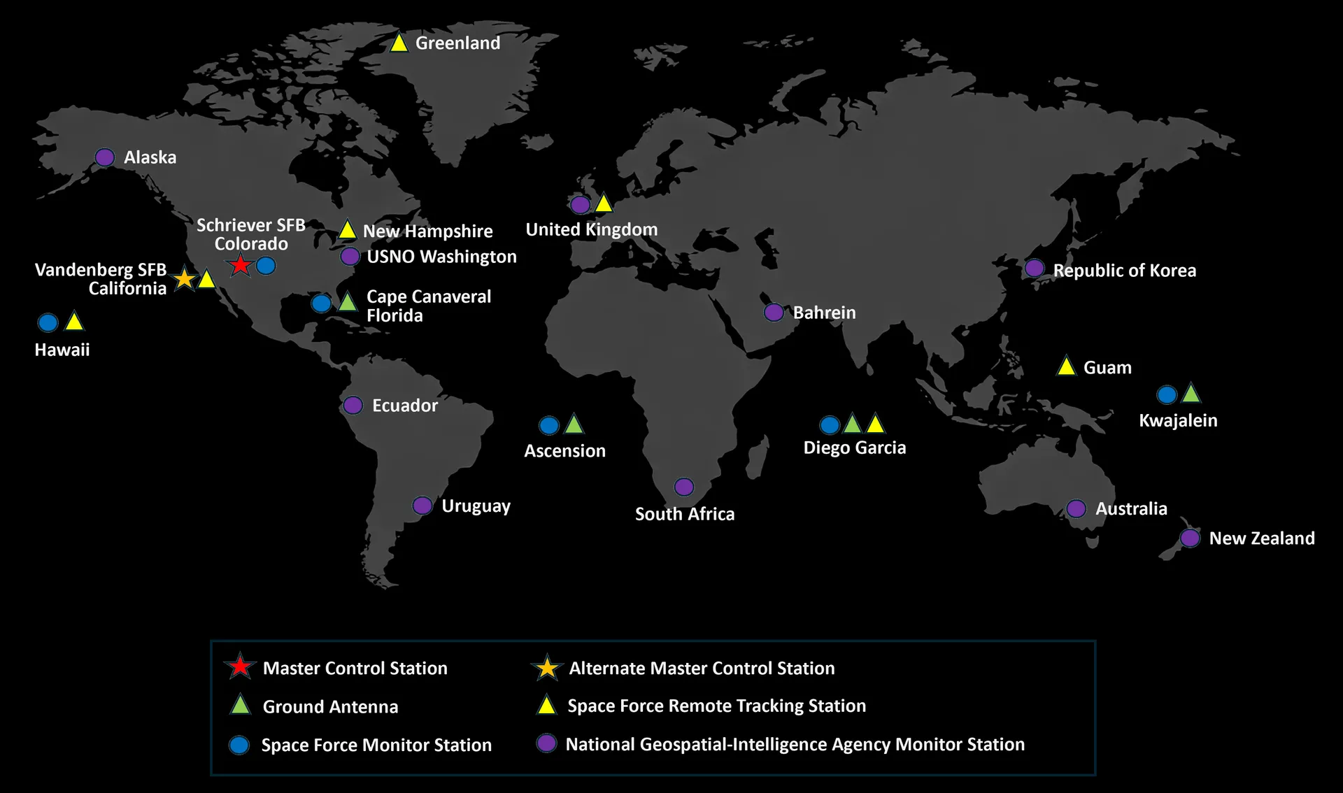
Monitor stations track the satellites as they pass overhead and collect their navigation signals, range measurements and atmospheric data. The master control station uses that worldwide data to compute the precise locations of the satellites and to generate the navigation messages uploaded to them; it monitors the satellites’ broadcasts and the integrity of the system, and resolves anomalies, including repositioning satellites to keep the constellation in its best arrangement. Ground antennas send commands, navigation data and software loads to the satellites over S-band and collect their telemetry.9
A ground system that never took control
Satellites are only half of a GPS generation. New satellites and new signals also need a ground system that can command them, and that is where the program has had its longest trouble.
The Air Force awarded the Next Generation Operational Control System, OCX, to Raytheon in February 2010 for $886 million, with its first two blocks forecast for completion in August 2015 and March 2016. It began development before completing preliminary design reviews, contrary to best practices. When development formally started in November 2012, the Air Force estimated the total cost of OCX at $3.5 billion, and its first detailed estimate put development alone at about $1.6 billion—by the Air Force’s own account, its first formal realization of how far the contract had been underbid.14 By 2017 the date for OCX to be ready to run the constellation had slipped 63 months, from October 2016 to January 2022, and the Air Force had created two stopgap programs, Contingency Operations and M-code Early Use, to modify the existing ground system so that it could fly GPS III satellites and broadcast a limited military signal.15
How two GPS dates moved15
The delays continued. In September 2024, GAO reported that the total cost of OCX Blocks 0, 1 and 2 had reached $7.6 billion as of November 2023, with final acceptance projected for December 2025.16 Space Operations Command accepted delivery from Raytheon in July 2025, but only after processing multiple deviations and waivers. The system still did not meet a requirement for steering GPS time, and testing of previously untested functions turned up a growing backlog of deficiencies, including in M-code handling, constellation management and cybersecurity. Studies completed in November 2025 compared the remaining work on OCX with upgrading the existing control segment and judged OCX the riskier path.18
The Space Force terminated OCX on April 17, 2026. By January 2026, $6.27 billion had been spent on it. “Despite repeated collaborative approaches by the entire government and contractor team, the challenges of onboarding the system in an operationally relevant timeline proved insurmountable,” said Col. Stephen Hobbs, the Mission Delta 31 commander.19 The existing Operational Control Segment, maintained by Lockheed Martin, will instead be enhanced to meet the requirements OCX was meant to satisfy.18,21
GPS IIIF: twenty-two more satellites, waiting on the ground
The next generation is GPS III Follow-On, built by Lockheed Martin. The first full estimate, in September 2018, covered 22 satellites—two paid for as development and twenty as procurement—at about $3.35 billion for development and $6.48 billion for procurement in fiscal 2021 dollars, or roughly $447 million per satellite.20 Beyond the GPS III design, GPS IIIF adds a steerable, high-power M-code signal known as Regional Military Protection to give troops greater resistance to jamming in contested areas.17 The Space Force says it will provide more than 60 times the anti-jam capability of legacy satellites.3 The satellites also add laser reflectors, a search-and-rescue payload, improved accuracy and better compatibility with other countries’ navigation systems.2,21
Production has slipped. In 2025 the program began accepting the mission data units, the brain of each satellite’s navigation mission, but problems with the amplifiers that boost the signal moved that work to a subcontractor, and the first ten satellites under contract had accumulated projected delivery delays averaging seven months since December 2024. As of January 2026, the third satellite placed on contract was expected to be the first delivered, in April 2027. In March 2025 the Air Force forecast that Regional Military Protection would reach full capability later than troops need it and told the Space Force to look at alternatives, including a mixed constellation with lower-cost satellites.18
The larger constraint is on the ground. GPS IIIF satellites were to be launched and flown through OCX Block 3F, an extension of the canceled system. Space Force officials told GAO they project ground control ready to launch and operate GPS IIIF satellites by 2028–29, whichever course they took.18 The fiscal 2027 budget request funds two more GPS IIIF satellites and continued development of satellites 11 through 22.21
Who pays for GPS, and what it returns
The American taxpayer pays for the GPS service used throughout the world: all GPS program funding comes from general U.S. tax revenues. The bulk of the program is budgeted through the Department of Defense, which develops, acquires, operates, sustains and modernizes GPS. The Department of Transportation funds civil signal performance monitoring and any capabilities with an exclusively civil use. U.S. law and policy require the civil service to be provided free of direct user fees, and there are no plans to privatize it.22
Defense Department funding for the GPS enterprise, by fiscal year21
Show the numbers
| year | Research and development | Procurement (satellites) |
|---|---|---|
| FY18 | $1.05B | $0.1B |
| FY19 | $1.29B | $0.1B |
| FY20 | $1.22B | $0.46B |
| FY21 | $1.12B | $0.63B |
| FY22 | $1.06B | $0.96B |
| FY23 | $0.92B | $0.75B |
| FY24 | $0.8B | $0.16B |
| FY25 | $0.76B | $0.7B |
| FY26 | $0.61B | $0.69B |
| FY27 | $0.57B | $0.68B |
Most of the swing from year to year is satellite buying. In fiscal 2024 the Defense Department bought no GPS satellites and spent $956 million on the program. The fiscal 2026 request asked for $703 million and again no satellites; the enacted budget, $1.29 billion, includes $686 million in procurement for two GPS IIIF satellites. The fiscal 2027 request is $1.25 billion, with two more.21
What that money buys is larger than the budget lines suggest. GPS technology is in everything from cell phones and wristwatches to bulldozers, shipping containers and ATMs. Precise positioning raises productivity in farming, construction, mining, surveying and package delivery, and communications networks, banks, financial markets and power grids depend on GPS for precise timing.23 A 2019 study commissioned by the National Institute of Standards and Technology estimated that GPS had generated $1.4 trillion in U.S. economic benefits since it became available in the 1980s. It also estimated that an outage could cost about $1 billion a day, and as much as $45 billion if a 30-day outage struck during the planting season. To date, GPS outages have lasted less than a day.24
- $1.4T
- U.S. economic benefits from GPS since the 1980s, 2019 estimate24
- $1B
- Estimated cost of each day of a GPS outage24
- $1.25B
- Defense Department GPS request for fiscal 202721
The constellation that SV-10 completed is still run from the ground system OCX was supposed to replace a decade ago. The next satellites are in production near Denver; the ground control needed to launch and fly them is projected for 2028–29.18,21
Sources
The text above is drawn from these 24 sources. Government works are adapted closely; company and press material is summarized. Numbers in the text point here. Last checked October 1, 2026.
Show all 24 sourcesShow fewer
- 1Back to the text
- 2Back to the text
- 3Back to the text
- 4Back to the text
- 5Back to the text
- 6Back to the text
- 7Back to the text
- 8Back to the text
- 9Back to the text
- 10Back to the text
- 11Back to the text
- 12Back to the text
- 13Back to the text
- 14Back to the text
- 15Back to the text
- 16Back to the text
- 17Back to the text
- 18Back to the text
- 19Back to the text
- 20Back to the text
- 21Back to the text
- 22Back to the text
- 23Back to the text
- 24Back to the text
Continue
Related stories
- OrbitsHeight sets a satellite’s speed; tilt and shape set what it sees. Five neighborhoods, from the station about 400 km up to Webb 1.5 million km away, and the work each one makes possible.
- LandsatSince 1972 Landsat satellites have recorded Earth’s land, and since 2008 anyone can download the record free. NASA builds them and the USGS runs them; the next one has been redesigned, and its budget is in dispute.
- Falcon 9NASA paid for milestones, not a rocket of its own design. The result now flies half the world’s launches and every American crew to orbit.